MOUNTAIN BIKING ON THE OUACHITA TRAIL
The Ouachita National Recreation Trail is the longest hiking trail in the state of Arkansas. The western end of the trail is in Talimena State Park in Oklahoma and the trail runs east for 223 miles to Pinnacle Mountain State Park near Little Rock, Arkansas.
Some 108 miles of this great trail has been designated as an Epic Trail by the International Mountain Biking Association (IMBA). This Epic Trail part of the Ouachita Trail extends from the Oklahoma/Arkansas border near Highway 88 (the Talimena National Scenic Byway) to Highway 7 north of Hot Springs Arkansas. This trail offers a variety of experiences to mountain bikers. There are challenging climbs, steep descents, stream crossings, beautiful vistas, and long stretches of remote trail to traverse.
There are many areas along this epic trail that will be difficult riding even for the most experienced mountain bikers. To ride the entire 109 miles would require a strong commitment to expedition mountain biking/camping and would include plenty of “hike a biking”. If you are interested in a shorter ride, there are many sections that lend themselves to a good trail ride and then (always using a good United States Forest Service map) take a gravel Forest Service (FS) road to loop back to the start. The mountain ridges, particularly to the west of Logan Gap back to Rich Mountain are very rocky and prone to dense weed growth. While the Friends of the Ouachita Trail work hard to clear the trail in all sections, these ridges are very difficult to keep clear. You may want to consider agreeing to adopt a section of trail to maintain.
A section of this Epic Trail in Montgomery County extending from FS 76 near Buck Knob on east to Rainey Creek Road was formerly used for the Ouachita Challenge mountain bike race. It makes for a good ride over Brushy Mountain, Blowout Mountain, Rock Row Mountain and Chalybeate Mountain. There are several FS roads that can be used to return or for a “bailout” if needed. This section might serve as a good introduction to the type of riding one can expect along the OT.
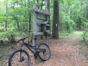
The entire length of the Epic Trail portion of the Ouachita Trail has a system of trail shelters (a nice log cabin sleeping area and porch) that are located about every 10 miles along the trail. The last three of the shelters in this chain will be completed this fall (2016). These shelters will accommodate a number of campers and are available on a first come, first served basis. They cannot be reserved. Each shelter includes a picnic table and a fire ring close to the shelter.
The Epic Trail designation for the Ouachita Trail by IMBA brings the number of Epic Trails in the state to five. The others are the Womble Trail, the Lake Ouachita Vista Trail, the Syllamo Trail, and the Upper Buffalo Trail. The only state with more Epic Trails at this writing is California. The Epic Trail portion of the OT runs within a few miles of the Lake Ouachita Vista Trail and the Womble Trail connects to the Ouachita Trail near Story, Arkansas. A mountain biker can easily plan to ride parts of all three of these three great trails on a long weekend.


